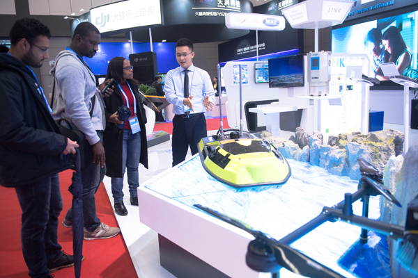
An exhibitor shows an unmanned survey vessel to visitors at the Geospatial Technology and Application Exhibition of the United Nations World Geospatial Information Congress 2018 (UNWGIC 2018) in Deqing county, East China’s Zhejiang province, Nov 18, 2018. The exhibition shows cutting-edge technologies and applications of more than 200 world exhibitors in fields such as geospatial information, satellite navigation and aerospace remote-sensing. [Photo/Xinhua]

A visitor experiences a face detection and analysis system at the Geospatial Technology and Application Exhibition of the United Nations World Geospatial Information Congress 2018 (UNWGIC 2018) in Deqing county, East China’s Zhejiang province, Nov 18, 2018. [Photo/Xinhua]
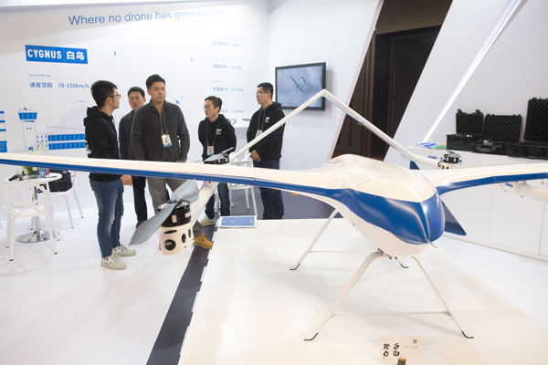
Visitors look at a drone system at the Geospatial Technology and Application Exhibition of the United Nations World Geospatial Information Congress 2018 (UNWGIC 2018) in Deqing county, East China’s Zhejiang province, Nov 18, 2018. [Photo/Xinhua]
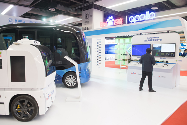
A visitor looks at autopilot vehicles based on high-precision intelligent maps at the Geospatial Technology and Application Exhibition of the United Nations World Geospatial Information Congress 2018 (UNWGIC 2018) in Deqing county, East China’s Zhejiang province, Nov 18, 2018. [Photo/Xinhua]
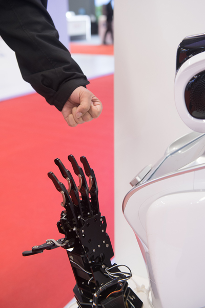
A visitor plays paper-scissors-rock with a robot at the Geospatial Technology and Application Exhibition of the United Nations World Geospatial Information Congress 2018 (UNWGIC 2018) in Deqing county, East China’s Zhejiang province, Nov 18, 2018. [Photo/Xinhua]

An exhibitor shows an IoT (internet of things) system at the Geospatial Technology and Application Exhibition of the United Nations World Geospatial Information Congress 2018 (UNWGIC 2018) in Deqing county, East China’s Zhejiang province, Nov 18, 2018. [Photo/Xinhua]